How to read this page: federal maps, applicant records, resident research, regional-history images, and present-day photographs are labeled by source and evidentiary weight. Publication permission does not turn an image into proof of a disputed fact or make a regional photograph site-specific.
Community landscape
Tarpon Woods residents describe a long-standing golf-course and neighborhood landscape with ponds, trees, open areas, homes, and Brooker Creek watershed connections. Those community descriptions provide context, but individual historical claims still require a dated primary source.
Parcel, deed, land-use, zoning, title, and permit-boundary questions must be resolved through the controlling records. Historical screenshots are research leads, not substitutes for current title, planning, survey, or County records.
Michelle Hollidge’s research trail, independently checked
The 1847 survey and later federal quadrangles
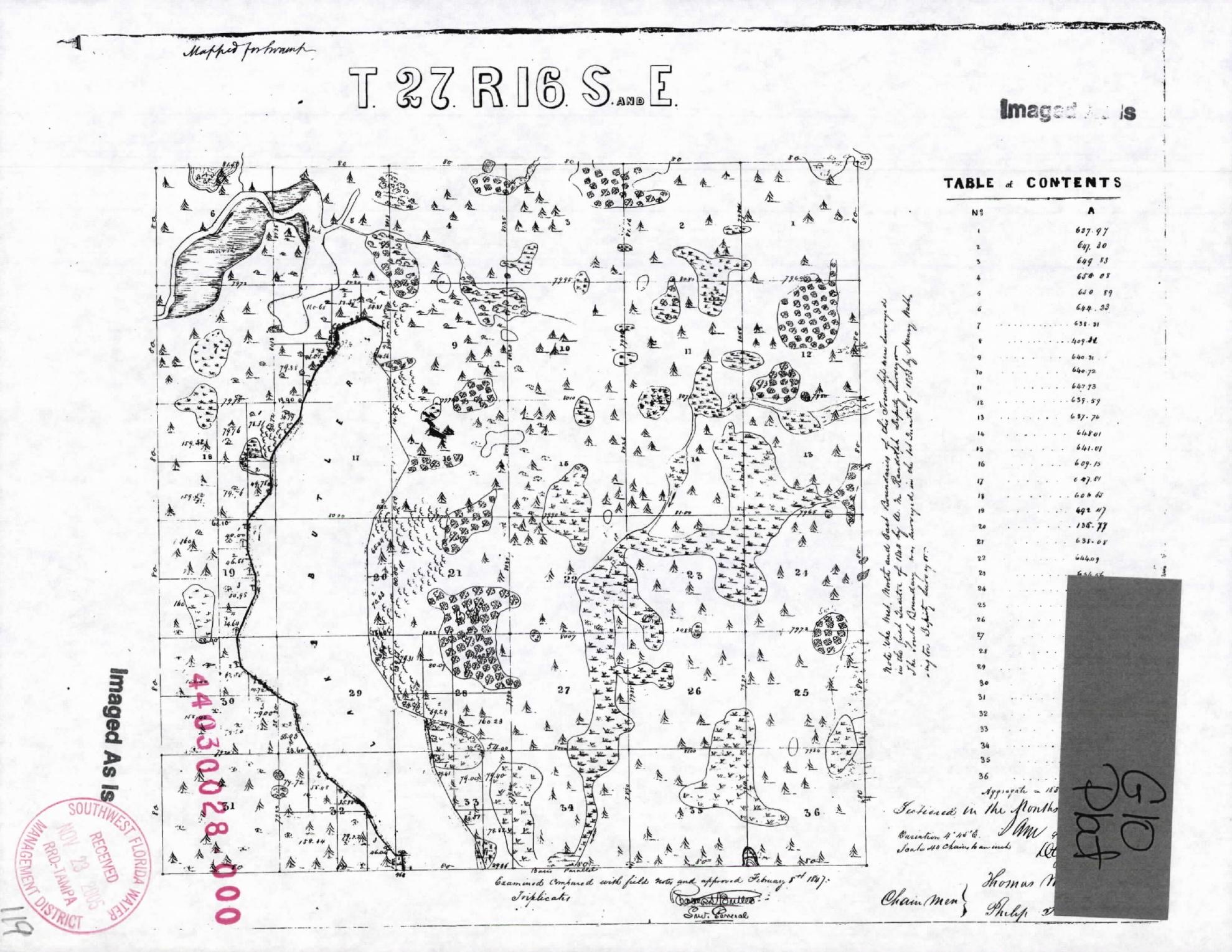
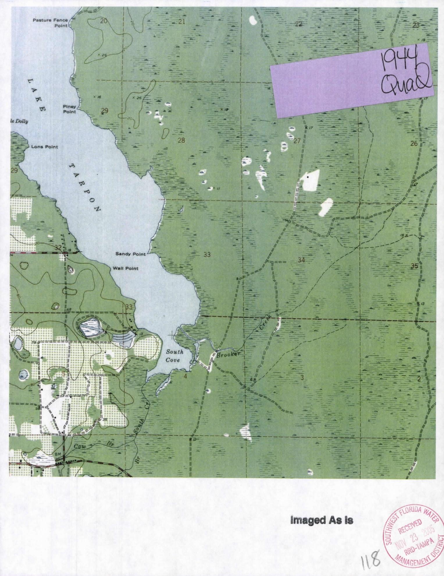
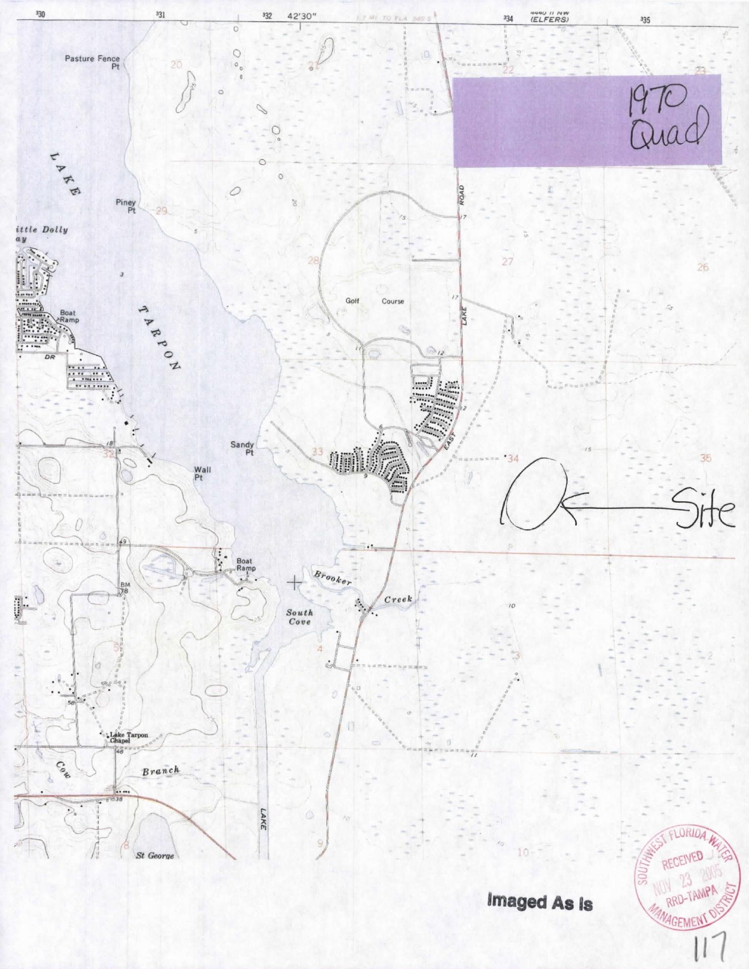
Longtime resident advocate Michelle Hollidge directed SWFWMD to pages 65–67 of the official 2005 Tarpon Woods Drainage Improvements application package. We retrieved that package from SWFWMD Application 57947 / ERP 30028.000 and confirmed that those pages reproduce an 1847 General Land Office township plat and federal quadrangle sheets labeled 1944 and 1970.
What these maps can and cannot establish: They are strong evidence of what surveyors and federal mapmakers depicted at particular times. They do not, by themselves, establish today’s wetland jurisdiction, ordinary high-water line, floodway, property boundary, soil condition, or the precise predevelopment hydroperiod. The 1847 symbols and handwritten notes require expert interpretation together with the original field notes, modern elevations, soils, aerials, and a current wetland delineation.
1847 GLO township plat. Section 34 is along the bottom row. The plat depicts pine symbols and separately patterned low or wet features, but it is not a modern wetland delineation. Source chain: federal survey reproduced at SWFWMD package page 67.Quadrangle labeled 1944. This regional sheet predates the golf course and neighborhood. The legend, scale, and mapmaking conventions must control any interpretation. Source: SWFWMD package page 66.Quadrangle labeled 1970. The sheet shows the golf-course area and Brooker Creek setting near the beginning of modern development. Source: SWFWMD package page 65.
What the historic record supports
The 1847 plat is consistent with a landscape containing both pine-dominated uplands and mapped wet or low features across the township. The later quadrangles document changing roads and development around Lake Tarpon and Brooker Creek. Together they justify requiring the applicant to explain, feature by feature, which areas it calls restoration, enhancement, creation, preservation, or upland supporting habitat.
What remains unresolved
The maps do not support the absolute statement that no wetlands ever existed anywhere in the present project area. Nor do they prove that every present wetland is natural or previously unaltered. SWFWMD should require a georeferenced overlay, original GLO field-note analysis, historic-aerial interpretation, soils and elevation evidence, and a current surveyed wetland line before accepting a “restoration” baseline or awarding credits.
FDEP's PATS_127253 archive documents a different, earlier project east of Tarpon Woods Boulevard
The names in this archive overlap with Tarpon Woods history, but the record must not be confused with the present golf-course parcels or mitigation-bank applicant. FDEP labels the facility “EAST OF TARPON WOODS BLVD.” Our review did not locate folio 34-27-16-00000-140-0000 or 34-27-16-00000-110-0400 on the reviewed sheets.
1986: several names describe the same evolving east-side development record
The official plans use the names Tarpon Woods Estates I, Ridgewood, and Woodridge Lakes. They document historical development, drainage, and mitigation planning in the broader Tarpon Woods area east of the boulevard. The changing names make this file useful for tracing older references that might otherwise look unrelated.
Limits: the plans identify different historical parties and do not establish work on today's golf-course parcels, a present wetland line, current ownership, or any conduct by the current applicant.
1987–1995: a wetland-fill permit and later agency performance concerns
FDEP permit 521272533 was issued May 29, 1987 and expired May 29, 1992. The file describes 0.75 acre of wetland fill for Bridlewood at Tarpon Woods and required 1.46 acres of forested-wetland mitigation. It names First Florida International as permittee and gives 800 Tarpon Woods Boulevard as its address.
An August 3, 1995 FDEP memo reports that an inspection found less than half of the required mitigation area had been created and much of the created area was herbaceous. The file also discusses an earlier warning and permit transfers; a separate memo says Parkwood performed the development.
Limits: those observations concern that older project and the conditions seen then. They do not prove present conditions, current-property work, a current mitigation failure, or wrongdoing by today's applicant.
Why publish this limited history: it shows that wetland fill, mitigation acreage, monitoring, transfers, and ecological performance have been part of agency review in the broader Tarpon Woods area for decades. It also shows why names and locations must be matched carefully. For Application 930235, SWFWMD should rely on current parcel-specific mapping, title evidence, baseline data, performance standards, and monitoring—not assume that an adjacent historical file proves or disproves anything about the proposed bank.
Evidence review
What Michelle’s filing adds to the public record
Michelle Hollidge’s 42-page submission is now itself part of SWFWMD’s official permit file. That establishes receipt and preserves its questions for review. It does not automatically turn every statement in the packet into an agency finding, so we checked the strongest points against earlier permit documents and original government sources.
The historic-map exhibits are in SWFWMD Application 57947 / ERP 30028.000.
The prior applicant-retained Phase I environmental assessment identified long-term golf-course chemical use as a business environmental risk and stated that soil and groundwater analysis and a soil-mitigation plan may be required before a land-use change.
EPA says MSMA is an organic arsenical, can convert to inorganic arsenic in soil, and may not be used in Florida except on cotton in twelve named counties.
EPA mitigation-bank guidance calls for scrutiny of contamination potential, floodplain goals, adjacent land uses, significant existing habitat, technical risk, financial assurances, contingencies, and performance-linked credit release.
Florida Rule 62-342.700 expressly addresses financial responsibility for both construction/implementation and perpetual management.
Material questions, not settled facts
Whether the applicant has demonstrated the exact real-property interest required for every acre in the proposed bank and conservation easement.
How Pinellas County’s wetland-buffer code applies to each proposed wetland edge; the code’s 50-foot standard is not automatically a 50-foot setback around the entire bank perimeter.
Whether the applicant’s credit acreage, planting density, cost estimate, release schedule, and current survey reconcile line by line.
Whether historic drainage infrastructure and modeled flood behavior remain compatible with the current design.
Whether the applicant demonstrates the incremental functional gain supporting each proposed credit under the applicable assessment and mitigation-bank rules, with transparent treatment of existing condition, preservation, protection, and proposed improvement.
Claims requiring a final primary record
Whether an FDACS inquiry reported in the resident filing remains open, and what its scope and official disposition are. Save Tarpon Woods has not independently verified an open investigation or located a final disposition.
Any conclusion that the property is contaminated; testing is needed.
Any conclusion that the entire project area was historically all upland or all wetland.
Any claim that the project will worsen or improve flooding without current signed-and-sealed modeling.
The presence and current legal status of each listed wildlife species; sightings, agency classifications, and survey dates must be checked species by species.
Our demand to SWFWMD: Resolve these items in writing before credit release or construction authorization. Where a prior applicant document conflicts with the current narrative, require the applicant to identify the conflict, state which version it relies on, provide the original supporting data, and explain the correction under professional certification.
The opposition’s full reading of Michelle’s filing
Why this filing strengthens the case to deny the application
Michelle Hollidge has worked beside this community from the beginning. Her August 26, 2026 submission does more than object in general terms: it connects the current application to older permit records, historic maps, environmental due-diligence material, flood concerns, property-control questions, mitigation-credit rules, financial-assurance requirements, and wildlife issues. Her filing gives SWFWMD a roadmap of questions it can no longer say were never raised.
Our position as the organized opposition is clear: when a commercial mitigation-bank record contains unresolved questions about boundaries, title and control, contamination risk, ground disturbance, inconsistent planting and cost figures, a proposed release schedule residents contend is too front-loaded before verified performance, and incomplete proof of long-term stewardship, the proper outcome is denial—not approval based on promises that essential details will arrive later.
1. The applicant must prove control of every acre
A mitigation bank is supposed to bind land and management obligations for the long term. That cannot rest on an approximate boundary, an incomplete transfer, or a promise to record documents later.
What the record raises
The current RAI response states that deed transfer and recordation remain in process. Earlier permit materials also generated questions about legal control over Parcel 3 and whether another owner or entity would need to participate. A survey can describe geometry, but it does not by itself prove present ownership, authority to encumber the land, or that every proposed bank acre will be inside the final conservation easement.
The public needs a parcel-by-parcel reconciliation showing record owner, applicant, legal interest, bank acreage, easement acreage, exclusions, access rights, existing encumbrances, and the document that authorizes each obligation.
Why this supports denial
Credits should not be issued against land the applicant has not conclusively demonstrated it can control and permanently manage. If the final deed, title evidence, joinders, access rights, and recordable easement are not complete and internally consistent, SWFWMD cannot reasonably assure that the promised work and perpetual restrictions are enforceable.
Our demand: deny the application if complete legal control is not established before approval. Do not substitute a future permit condition for a prerequisite that determines whether the applicant can lawfully deliver the bank at all.
2. Existing wetlands and functioning habitat are not newly created improvements
The central accounting question is not simply how many acres fall inside the proposed boundary. It is what ecological function already exists, what measurable additional function the applicant will produce, and which portion—if any—is eligible for credit.
What must be reconciled
Existing wetlands and surface waters, including their current condition and regulatory status.
Existing floodway and floodplain functions that already convey or store water.
Existing tree canopy, soils, root systems, wildlife use, and upland support that already benefit adjacent wetlands.
Historic alterations such as golf-course grading, ponds, ditches, drainage works, and managed turf.
Each proposed restoration, enhancement, creation, preservation, and upland-support polygon.
The assessment score before work, the predicted score after work, and the incremental functional gain assigned to each polygon.
The opposition’s conclusion
The applicant should not receive credits merely for placing an existing wetland, existing floodway, or already-functioning upland inside a bank boundary. Preservation and upland-support credit may be available under governing rules in appropriate circumstances, but it must be justified as additional value—not assumed from acreage alone.
Our demand: one signed-and-sealed, georeferenced credit map and acreage table that lets any reviewer trace every tenth of an acre from existing condition to proposed action to claimed credit. Any unexplained overlap or double counting should be resolved against credit issuance.
3. Historic maps challenge an oversimplified ecological story
Michelle identified the 1847 GLO plat and the federal quadrangles labeled 1944 and 1970 in an older SWFWMD drainage file. Those maps matter because mitigation credit depends on a defensible baseline and a defensible explanation of what is being restored.
1847
The township plat depicts pine symbols and separately patterned low or wet features across the surveyed landscape. It does not prove that the entire modern project was upland or wetland. It does show that a blanket historical description is inadequate and that the original field notes deserve professional interpretation.
1944
The federal quadrangle predates the modern neighborhood and golf-course configuration. It provides regional context for Brooker Creek, Lake Tarpon, roads, and drainage features, but its scale cannot replace a current delineation.
1970
The later quadrangle shows the area near the beginning of modern development. Comparing it with later aerials and drainage plans can help distinguish natural features, golf-course modifications, and subsequent infrastructure.
Our demand: require the applicant to georeference these maps and the original GLO field notes against modern topography, soils, historic aerials, drainage records, and the current surveyed wetland line. If the applicant cannot demonstrate what condition is historic, what is altered, and what is presently functioning, SWFWMD should not award restoration credit on an assumed narrative.
4. Former golf-course soils must be tested before they are disturbed
Michelle’s filing connects the proposal to earlier environmental due-diligence material describing long-term golf-course chemical use as a business environmental risk. It also reports an unresolved investigation involving alleged Target 6 Plus use. Neither point proves contamination at Tarpon Woods—but together they make “no testing needed” an indefensible assumption.
What is verified and what is not
EPA identifies MSMA as an organic arsenical and explains that organic arsenic can transform into inorganic arsenic in soil. EPA also states that MSMA use in Florida is restricted to cotton in specified counties. Those general facts justify investigation; they do not establish that a particular product was applied here, at what rate, or that site soil exceeds any cleanup or disposal criterion.
The reported FDACS investigation must be resolved through its final agency record. Until then, the allegation should remain labeled as pending and unproven.
What testing must cover
Systematic background sampling across former tees, greens, fairways, roughs, maintenance areas, chemical storage or mixing areas, drainage paths, pond margins, and proposed work zones.
Targeted sampling wherever staining, stressed vegetation, storage history, or prior records identify a possible release.
Sampling at proposed planting locations and at intervals representative of the more than 60,000 proposed plants.
Depth intervals matching planting holes, root balls, ditch work, equipment rutting, grading, excavation, and any utility or monitoring installation.
Laboratory methods, detection limits, quality assurance, chain of custody, and comparison criteria identified before sampling.
Waste characterization, worker protection, dust and runoff controls, transportation requirements, disposal facilities, and certified costs if impacted soil is encountered.
5. The planting numbers, disturbance, and costs must agree
The proposal is described as avoiding earthwork while also relying on extensive planting and ditch-related restoration. More than 60,000 plants cannot be treated as if they enter the ground without holes, displaced material, equipment access, soil contact, and potential effects on roots, microorganisms, fungi, insects, soil structure, and water movement.
A conservative displacement example
At only one cubic foot per plant, 60,000 plants would create 60,000 cubic feet of planting-hole volume—about 2,222 cubic yards. Spread one foot deep, that volume covers approximately 1.38 acres. This is not a prediction of the final disturbed volume: small plugs may require less, while pines and larger container plants may require substantially more. It demonstrates why plant size, container size, hole dimensions, spacing, installation method, soil reuse, and excess-material disposition must be disclosed.
If displaced soil is spread nearby, the applicant must show whether finished elevations, flood storage, runoff paths, or wetland hydroperiods change. If removed, the applicant must identify characterization, transport, and lawful disposal.
Internal consistency
The reviewed response reportedly uses different pine densities in the work plan and cost estimate—75 per acre in one place and funding for 40 per acre in another—and contains an apparent Year 15 arithmetic problem. These may be correctable errors, but they directly affect ecological feasibility and financial assurance.
Our demand: a final planting plan showing species, quantities, sizes, spacing, exact polygons, installation details, replacement assumptions, survival standards, monitoring, access, and a professionally certified cost estimate using the same quantities. If the plants physically cannot fit, survive, or be funded as represented, the credit claim must be reduced or the application denied.
6. Credit release must follow performance, and perpetual promises must be funded
Mitigation credits may be sold to offset impacts elsewhere. Once those impacts occur, failure at the bank creates a public ecological liability. That is why credit release, corrective-action money, and perpetual management cannot depend on optimism about future cash flow.
The risk residents see
The response proposes releasing a substantial majority of credits before an interim ecological success level is demonstrated. Early credits may generate revenue before the most difficult biological and hydrologic results are known. If establishment fails, contamination raises costs, ownership changes, or the operator defaults, the remaining unsold credits may not finance correction.
A conservation easement restricts land use; it does not itself place cash in an account, hire a replacement manager, correct hydrology, replace failed plants, control invasives, or safely remove contaminated material.
An irrevocable instrument—such as an authorized trust, escrow, bond, letter of credit with standby trust, or stronger combination—that remains available after ownership or operator changes.
Certified costs with inflation, contingency, mobilization, professional services, testing, disposal, replacement planting, invasive control, storm recovery, and emergency work.
Clear draw conditions, replenishment requirements, replacement-manager authority, default remedies, and District access.
Credit releases tied to verified hydrologic and ecological performance, not merely document execution or elapsed time.
Our demand: no approval and no credit release until SWFWMD demonstrates that the public will not inherit the cost of failure.
7. Wildlife and flood risk require current, project-wide evidence
Old observations, limited surveys, and general habitat descriptions cannot answer what species use the property now or how the final work could affect nesting, foraging, movement, refuge, and flood behavior.
Wildlife
Require current seasonal surveys by qualified professionals across the complete proposed bank, access routes, staging areas, and management zones. The record should distinguish direct observations, suitable habitat, agency database records, survey dates, methods, weather, coverage, and limitations. Species-specific avoidance, buffers, timing restrictions, monitoring, and stop-work procedures should be enforceable conditions—not deferred suggestions.
Flooding
The FEMA regulatory floodway follows Brooker Creek through the broader landscape, and the neighboring pool review shows that even a small encroachment can trigger watershed-scale modeling and compensatory-storage questions. The applicant must overlay the effective floodway with every credit polygon and every proposed disturbance, demonstrate no rise or adverse impact under applicable standards, and obtain County and FEMA approvals where required.
SWFWMD should deny this application unless the applicant first closes every material gap
Michelle’s filing, the applicants’ own submissions, the prior permit history, and the public-source research do not describe a project ready for approval. They describe a proposal whose essential acreage, baseline, title, hydrology, floodway interaction, soil condition, planting feasibility, cost, wildlife protections, credit-release safeguards, and perpetual funding still require proof.
Residents should not be told to trust that these matters will be solved after approval. Mitigation credits can authorize damage elsewhere, and some environmental losses cannot be easily reversed. The burden belongs to the applicant now—not to neighbors after flooding changes, plantings fail, soil is disturbed, credits are sold, or the operator defaults.
We call on residents to oppose the application and on SWFWMD to deny it unless and until the applicant supplies complete, consistent, professionally certified, independently reviewable, and enforceable answers. If those answers cannot be produced during permitting, there is no reasonable basis to assume they will appear during decades of implementation and perpetual management.
The three filings share a project name and permit family, but their designs and procedural statuses are not interchangeable. Dates are repeated here only as a short orientation; the application comparison is the detailed record.
Filed March 1, 2024. SWFWMD issued an RAI and later clarification; the record contains responses, extensions, plans, and comments. The applicant withdrew it effective December 6, 2024, and SWFWMD acknowledged the withdrawal December 11.
Filed December 6, 2024 and withdrawn November 13, 2025. All 102 documents publicly listed in its SWFWMD viewer at retrieval show an applicant design proposing major excavation, pond and ditch filling, wetland creation, material export, a 172.59-acre easement, and a stated total of 79.57 potential credits. Its displayed 13.86- and 65.72-credit components sum to 79.58, a one-hundredth difference that may reflect rounding and requires reconciliation. SWFWMD’s September clarification said the file remained incomplete.
Limit: the retrieved viewer archive is not represented as SWFWMD’s entire internal file. Proposed quantities in a withdrawn application are not approved work, released credits, or proof of the current design.
Filed November 14, 2025. SWFWMD issued a separate RAI dated December 14, 2025. A partial response, extension filings, and the August 26, 2026 response followed. Filing a response is not a completeness determination or approval.
Why this matters: the middle application is the missing bridge between the early conceptual plan and today’s “no earthwork” account. SWFWMD should require a signed-and-sealed change matrix showing what happened to every excavation, fill, pond, ditch, pipe, access route, disposal plan, credit polygon, and conservation-easement boundary before it treats the current design as complete.
Released visual archive
Palm Harbor history and the Tarpon Woods landscape
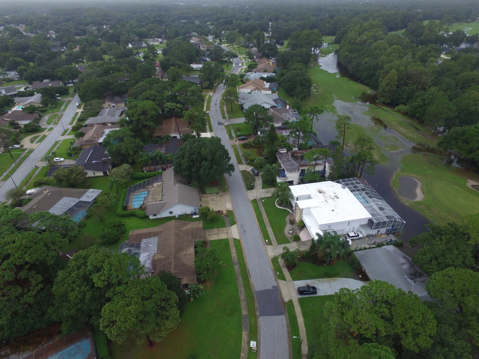
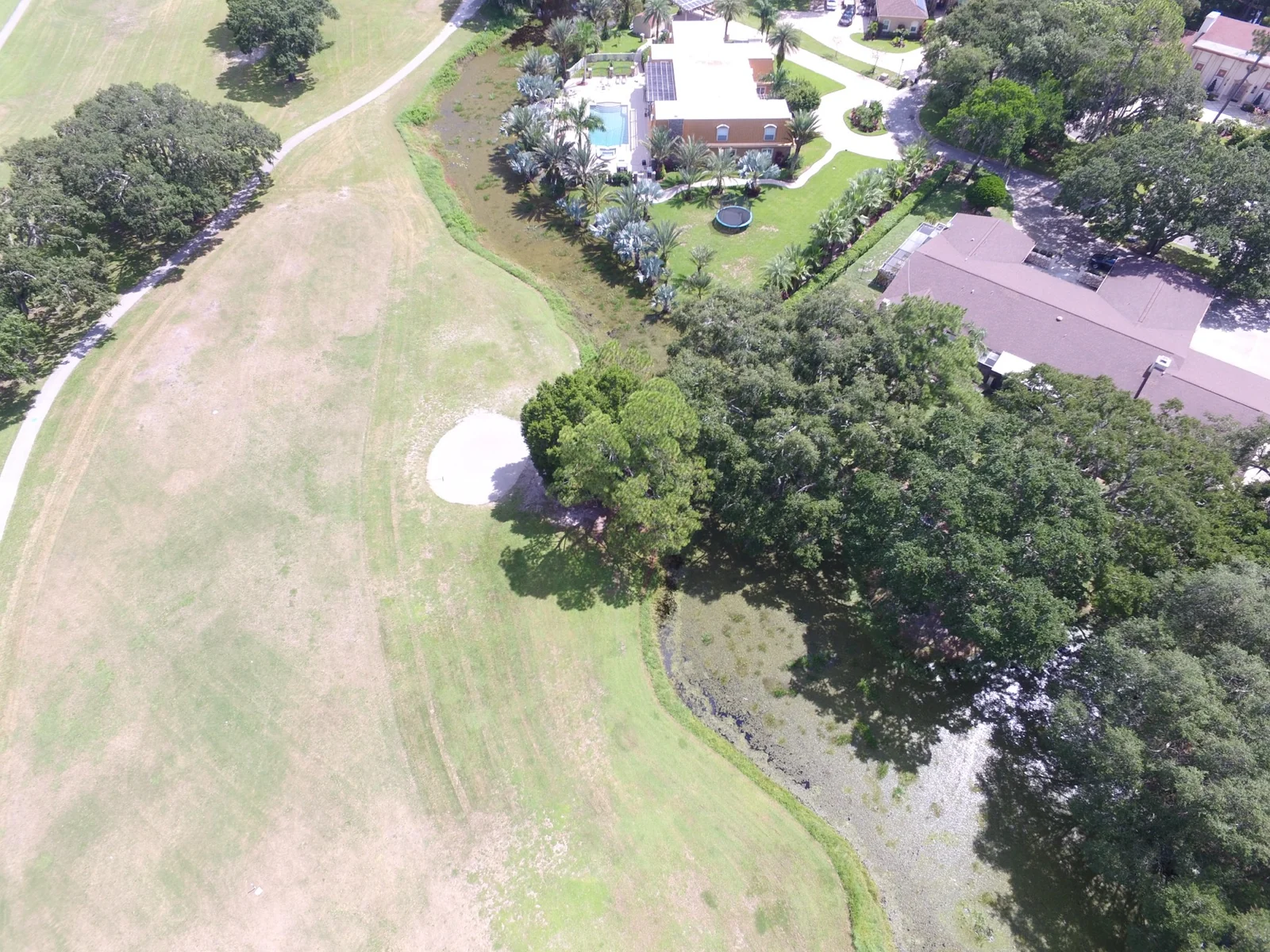
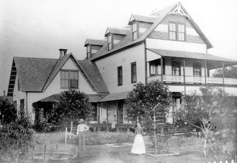
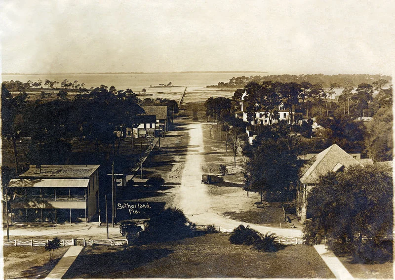
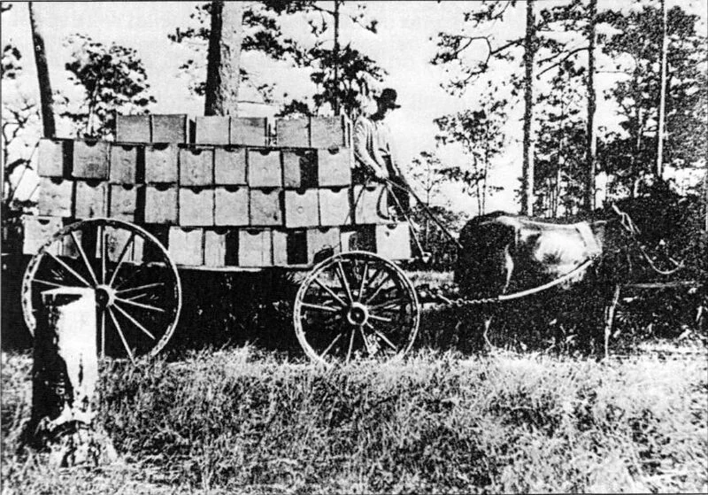
The site owner has represented that publication on SaveTarponWoods.com is authorized as of September 2, 2026. These images are offered with source labels and careful limits: regional-history photographs provide context, while modern aerials show the course landscape but do not establish regulatory boundaries or environmental conditions.
Tarpon Woods from above. Owner-authorized archive photograph showing the interwoven course, water, trees, and neighborhood. It is visual context, not a survey, flood map, or jurisdictional delineation.A connected green-space landscape. The photograph shows why the proposal cannot be evaluated as isolated polygons on paper. Exact date and flight position are not independently verified.Golf-course history. Archive image labeled “Tommy Bolt — Tarpon Woods.” The caption preserves the archive attribution; the precise date and original publisher should be verified before scholarly reuse.Palm Harbor, labeled late 1800s. Regional context supplied with a Palm Harbor Museum source label. It is not represented as a photograph of the present project property.Sutherland, labeled early 1900s. Regional Palm Harbor history, not site-specific evidence. Source label supplied with the archive: Palm Harbor Museum.Palm Harbor citrus history, labeled 1915. Regional context only. The image does not establish the historic use or condition of the current mitigation-bank acreage.Regional Indigenous-history context. Archive image labeled “Tocobaga temple mound — Pinellas.” It is not evidence that a mound or archaeological resource exists on the proposed bank property; any site-specific conclusion requires professional review.
Reuse note: The site owner has represented that publication on SaveTarponWoods.com is authorized. That representation does not place any image in the public domain, transfer copyright, or authorize unrelated redistribution. Outside users should preserve the displayed credit and obtain reuse permission from the credited rights holder; contact Save Tarpon Woods if the rights holder is unclear.
New official environmental-history records
FDEP's files confirm prior drainage work, a historical diesel discharge, and a current tank-account record at 1100 Tarpon Woods Boulevard
These records materially strengthen the demand for a current, site-specific environmental baseline. They do not establish that the property is contaminated today. They establish that a reviewer cannot responsibly dismiss testing, mapping, and contingency planning without first reconciling the official history.
FDEP's historical file contains an August 1990 notification reporting a diesel discharge detected through soil analysis/OVA-FID. A closure-report package received in March 1991 describes removal of gasoline and diesel underground tanks, excavation of approximately 80 cubic yards of soil with elevated field-vapor readings at the diesel pit, laboratory soil results below detection limits, a gasoline-pit groundwater sample slightly above the then-state benzene target, and a later nondetect result from one temporary monitoring well. Later correspondence identified closure-report deficiencies.
What it does not prove: these events do not establish current contamination, the present location or condition of every affected area, an open enforcement case, or an agency no-further-action determination. They identify precise historical areas and pathways that a current professional assessment should locate and evaluate.
Current tank-account snapshot
FDEP's DOPPLER cover report, run September 1, 2026 from data refreshed August 31, identifies facility 8624510 at the exact address as a fuel-user/non-retail facility with status “OPEN.” It lists one 550-gallon vehicular-diesel aboveground tank and one 550-gallon unleaded-gasoline aboveground tank as “In Service,” plus three other tanks as removed. Its current summary also states “No Compliance Activity Data Found,” “No Open AOCs Found,” “No Open Violations Found,” “No Discharges Found,” and “No Property Owner Information Found.”
Read the current fields correctly: “OPEN” is the storage-tank facility/account status, not a finding of an open contamination or enforcement case. Conversely, the current “No Discharges Found” field does not erase or resolve the separate 1990–1991 documents; it reports what the present DOPPLER summary displays. The report lists no property-owner information and cannot establish legal title, current soil or groundwater quality, a no-further-action decision, or the location of every historical condition. Its removed-tank inventory also differs from the 1991 consultant report, so each source must remain separate until FDEP or a qualified professional reconciles them.
Drainage work tied to Brooker Creek
FDEP construction-stormwater record FLR10BW24 reports 3.73 disturbed acres at the address and identifies “Brooker Creek Channel A (tributary to Lake Tarpon)” as receiving water. Later record FLR10MM29 reports 4.1 disturbed acres and identifies “BROOKER CREEK” as receiving water. The current facility reports list both records inactive.
What that means: these are historical construction-general-permit records, not mitigation-bank approvals or current hydrologic models. They are official evidence of prior exact-address disturbance and of the receiving-water connection that must be built into any credible baseline and cumulative-impact review.
Our demand: before SWFWMD accepts more than 60,000 plant installations, ditch work, equipment access, or any soil displacement, require the applicant to map every current and former tank, excavation, known discharge area, drainage-work footprint, maintenance or chemical-handling area, and proposed disturbance. Require a current Phase I update, appropriately scoped soil and groundwater sampling, a quality-assured sampling plan, worker and water-protection controls, lawful handling and disposal procedures, replacement-planting contingencies, and certified costs. If the applicant cannot demonstrate that the proposed work will avoid mobilizing contaminants and will succeed in the actual soil conditions, SWFWMD should deny the application.
Recorded-property checkpoints
The 2019 County waiver was limited to 3.40 acres; current assessor pages do not supply the missing deed citation
Two official record sets add important—but carefully limited—context to the applicant's title, survey, utility, and conservation-easement showing. Neither source substitutes for a complete current title chain.
2019: the County released specified rights only on a described 3.40-acre tract
Pinellas Clerk Instrument 2019338177, Official Records Book 20738, Page 2541, concerns County rights arising from an earlier agreement for golf-course management and maintenance, treated-effluent disposal, and a right of first refusal. The recorded waiver releases the specified rights only as to the 3.40-acre tract in Exhibit A. It expressly says the waiver applies to that tract and not to the remainder of the Golf Course Property.
The instrument also says the earlier agreement remains effective on the balance, including continued acceptance of treated effluent. The metes-and-bounds courses in the 3.40-acre Exhibit A appear again in Application 930235 title material as Parcel 3 (Fee Estate).
Limits: this is not evidence that the County released the stated rights over the entire golf-course property. The matching description is a document-reconciliation fact, not a title opinion, present-ownership determination, or conclusion about whether later recorded instruments changed any right.
2022 sale indexing: both folios point to the applicant, but the deed field is a placeholder
The Property Appraiser currently indexes both folios—34-27-16-00000-140-0000 and 34-27-16-00000-110-0400—to TARPON WOODS PROPERTIES LLC. Each page lists a February 3, 2022 unqualified sale for $1,650,000. Each also displays AAAAA/AAAA in the “Last Recorded Deed / Book-Page” field rather than an identifiable Clerk instrument and official-record book/page.
Limits: assessor ownership and sale indexing can guide research, but it is not a Clerk deed citation, title opinion, surveyed legal boundary, or proof of authority to place every project acre under a conservation easement. The applicant must supply the controlling recorded deed, current title evidence, and a parcel-by-parcel crosswalk to the survey, bank, credit, security, and conservation-easement boundaries.
Why this matters to the permit: SWFWMD should require the applicant to plot the 3.40-acre Exhibit A tract against the current Parcels 1, 2, and 3; identify which recorded County rights affect each remaining area; produce every later instrument on which it relies; and explain how those rights interact with access, reclaimed-water or treated-effluent obligations, perpetual management, and the proposed conservation easement. The District should not infer a whole-property release from a tract-specific waiver or infer a complete title chain from an assessor page whose deed field does not name the controlling instrument.